The next few posts will be catch up posts and so are out of chronological order...
Even though today is April 16, we are going back to the end of March to cover some beautiful canyon areas in Arizona.
The pink highlighted line is, of course, our meandering itinerary. From the Grand Canyon South Rim (middle of the map, circled in pink), we headed due east to Cameron and then straight North. The first area in brown to the left of our pink line includes Lee's Ferry, Glen canyon, which is what this post is about.
Hence, Lee's Ferry, March 27-28, 2016
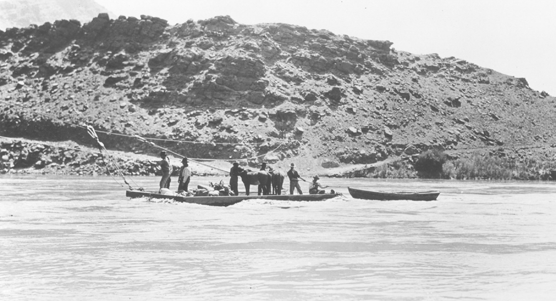
Lee's ferry was originally established in 1873 to offer transportation across the Colorado River for Mormon pioneers who were heading from Utah into Arizona. This was the only spot for hundreds of miles where the canyon walls flanking the river became less than vertical and allowed wagons and livestock to make their way to the river's edge.

The ferry operated for 55 years and by the 1900s, it had essentially been replaced by railroad and car travel. The ferry made its last crossing in 1928. Today, the site is part of the Glen Canyon recreational Area and, as such, is operated by the National Park service. There is a small campground, but the main recreation function is to launch river trips down the mighty Colorado River, through the Grand Canyon!
One can see ruins of the ferry buildings and machinery as well as a sunken barge. Hiking in the area leads, as always, to beautiful vistas.
 | |
| Looking toward the campground area from the ferry |
 |
| Driving into Lee's Ferry area |
 |
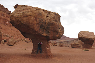
| Unusual rock formation, created by wind erosion |
 | ||
| Our view of the Colorado River from the campground |
 |
| Life finds its way among the rocks |
 | |||
| Indeed, we found the mighty Colorado to be but a trickle at times...Interestingly, this was on a panel by the river at Lee's Ferry. |
Just outside the Lee's Ferry area is the "Navajo Bridge". According to the website, "It was an historic day when, on January 12, 1929, the bridge was opened to traffic. At the time, it was the highest steel arch bridge in the world and made traveling between Utah and Arizona much easier. No longer did travelers have to contend with the moods of the Colorado River at Lees Ferry. The dedication of the bridge took place June 14-15, 1929. For such an isolated spot, it was an astounding event. Nearly 7,000 people in 1,217 automobiles arrived for the celebration. Speeches were given by the governors of Arizona, New Mexico, and Utah and by the President of the Mormon Church. Bands, choral groups, and Native American dancers were also a part of the festivities. It was reported that airplanes flew under the bridge and as Prohibition was in effect, the bridge was christened with a bottle of ginger ale. The bridge was known as the Grand Canyon Bridge for five years following the dedication. In 1934, after great debate in the Arizona legislature, the official name was changed to Navajo Bridge."
The bridge was closed in 1995 because it could no longer cope with the weight of the increasing traffic. The Navajo Bridge is now a walking bridge, spanning the river and taking one from the Federal recreation area to Navajo land. The view from the bridge is predictably beautiful. A new, stronger bridge was opened just beside the original one (one can just see the edge of the new bridge in the above photo.
 | |
| View from the Navajo bridge |
It is also the site where, if lucky, one can see the endangered American condor, which has been brought back from near extinction. The birds are tagged and monitored. Here is adolescent female #722 resting on a cliff below the bridge.
 | |
| Are the ducks telling us it is time to start North? |


No comments:
Post a Comment